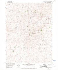
1958 Map of Swales Mountain
USGS Topo · Published 1967About this map
Independence Mountains topography dominates this mid-century survey, revealing a landscape defined by high-altitude peaks and active resource extraction. The terrain is marked by significant elevations like Swales Mountain and Fish Creek Mountain, which overlook a network of seasonal drainages including Red House Creek, Donna Creek, and Cottonwood Creek. Human impact on this remote environment is evident through the numerous Strip Mine excavations, prospects, and shafts clustered near the mountain basins. A particularly distinctive feature is the Carlin Drift Fence, which traverses the central ridges to manage livestock movement across the high country. Navigation is limited to a network of jeep trails, while modern communication is represented by the VABM TV Repeater Station. Water sources are critical in this arid landscape, documented through numerous locations such as Yellow Spring, Mine Spring, and Mud Springs.
Find a feature on this map
27 named features on this map. Tap any name to fly to it.
Don’t see what you’re looking for? This feature index may not catch every label — zoom into the map to look around manually.
Map Details
Editions of this 1958 Swales Mountain Map
3 editions found
Other maps of this area

1955 · McDermitt
USGS Topo · 1:250,000

1955 · Wells
USGS Topo · 1:250,000

1955 · Winnemucca
USGS Topo · 1:250,000

1955 · Elko
USGS Topo · 1:250,000

1958 · Winnemucca
USGS Topo · 1:250,000

1958 · Wells
USGS Topo · 1:250,000

1958 · Elko
USGS Topo · 1:250,000

1958 · Singletree Creek
USGS Topo · 1:24,000

1958 · Hunter
USGS Topo · 1:24,000

1958 · Blue Basin
USGS Topo · 1:24,000