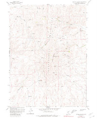
1958 Map of Swales Mountain
USGS Topo · Published 1980About this map
The high ridges of the Independence Mountains and Swales Mountains dominate this Elko County landscape, where the focus in the late 1950s was clearly on resource extraction and water management. Mining activity is concentrated around Swales Mountain, marked by numerous labels for prospects, shafts, and tunnels, alongside a Strip Mine further west.
Find a feature on this map
25 named features on this map. Tap any name to fly to it.
Don’t see what you’re looking for? This feature index may not catch every label — zoom into the map to look around manually.
Map Details
Editions of this 1958 Swales Mountain Map
3 editions found
Other maps of this area

1955 · McDermitt
USGS Topo · 1:250,000

1955 · Wells
USGS Topo · 1:250,000

1955 · Winnemucca
USGS Topo · 1:250,000

1955 · Elko
USGS Topo · 1:250,000

1958 · Winnemucca
USGS Topo · 1:250,000

1958 · Wells
USGS Topo · 1:250,000

1958 · Elko
USGS Topo · 1:250,000

1958 · Singletree Creek
USGS Topo · 1:24,000

1958 · Hunter
USGS Topo · 1:24,000

1958 · Blue Basin
USGS Topo · 1:24,000