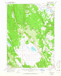
1957 Map of Swan Lake
USGS Topo · Published 1965About this map
The Sprague River winds through the northeast corner of this Klamath County landscape, defining the northern edge of the Sprague River Valley just as the Winema National Forest extends across the high timberland of the Wheeler Plateau. In the lower elevations, the transition from forest to the pastoral Swan Lake Valley is marked by a concentration of ranching history and local landmarks. This mid-century survey illustrates the rural infrastructure of the era, from the Oregon Technical Institute at the foot of Hogback Mountain to the remote Xenia stop. Family heritage is deeply rooted here, preserved in sites like Gabriel Cem and Hibbert Cem, alongside numerous working lands such as Coleman Ranch and Drews Ranch. The Oregon California and Eastern RR cuts through the eastern valleys, highlighting the importance of rail transport to the local timber and agricultural economy.
Find a feature on this map
100 named features on this map. Tap any name to fly to it.
Don’t see what you’re looking for? This feature index may not catch every label — zoom into the map to look around manually.
Map Details
Editions of this 1957 Swan Lake Map
3 editions found
Other maps of this area

1889 · Klamath
USGS Topo · 1:250,000

1894 · Klamath
USGS Topo · 1:250,000

1955 · Klamath Falls
USGS Topo · 1:250,000

1956 · Calimus Butte
USGS Topo · 1:62,500

1957 · Merrill
USGS Topo · 1:62,500

1957 · Chiloquin
USGS Topo · 1:62,500

1957 · Swan Lake
USGS Topo · 1:62,500

1957 · Klamath Falls
USGS Topo · 1:62,500

1957 · Malin
USGS Topo · 1:62,500

1957 · Modoc Point
USGS Topo · 1:62,500