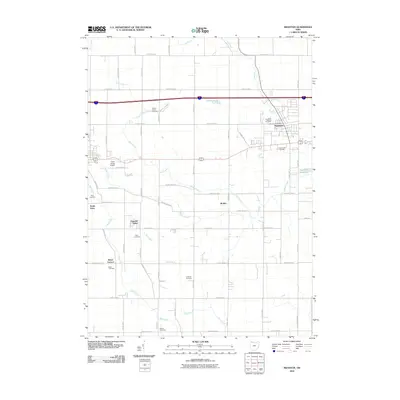
2010 Map of Swanton
USGS Topo · Published 2010About this map
Swanton serves as the primary municipal hub in this northwestern Ohio landscape, anchored by the Swanton Post Office and the nearby Swanton Reservoir. The region is defined by a dense network of county roads that carve the terrain into a predictable agricultural grid, interspersed with small community clusters like Brailey, South Delta, and Peaceful Valley. This 2010 survey reveals a significant concentration of local heritage sites, with numerous burial grounds such as Fulton Union Cemetery, Saint Richards Cemetery, and the Lutheran Cemetery preserving family names and settlement history. Waterways like Swan Creek and its tributaries, including Fearless Creek and Bad Creek, wind through the township, influencing the placement of early homesteads and current landmarks like the Delta Wings Airport. The map documents a classic Midwestern crossroads economy where small-town infrastructure meets expansive rural homesteads.
Find a feature on this map
50 named features on this map. Tap any name to fly to it.
Don’t see what you’re looking for? This feature index may not catch every label — zoom into the map to look around manually.
Map Details
Editions of this 2010 Swanton Map
This is the sole edition of this map. No revisions or reprints were ever made.
Other maps of this area

1908 · Napoleon
USGS Topo · 1:62,500

1909 · Mc Clure
USGS Topo · 1:62,500

1911 · Wauseon
USGS Topo · 1:62,500

1911 · Swanton
USGS Topo · 1:62,500

1913 · Wauseon
USGS Topo · 1:62,500

1914 · Swanton
USGS Topo · 1:62,500

1935 · Grand Rapids
USGS Topo · 1:24,000

1935 · Whitehouse
USGS Topo · 1:24,000

1935 · Berkey
USGS Topo · 1:24,000

1939 · Berkey
USGS Topo · 1:31,680