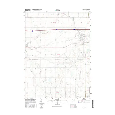
2016 Map of Swanton
USGS Topo · Published 2016About this map
Swanton and Delta anchor this portion of the Ohio landscape, where the flat agricultural terrain is defined by a dense grid of township and county roads. The drainage pattern is led by Swan Cr and Blue Cr, which wind through the township sections toward the Swanton Reservoir. A notable modern recreational feature is the N Country National Scenic Trail, which cuts horizontally across the center of the map through Brailey. For genealogists, the map is remarkably dense with burial sites, documenting the deep-rooted local history at Fulton Union Cem, Centerville Cem, and several others like Lutheran Cem and Shiloh Cem. The transition from the developed streets of Swanton, such as Broadway Ave and Main St, to the rural expanse of Fulton and Lucas counties illustrates the continued balance between small-town growth and traditional farming.
Find a feature on this map
96 named features on this map. Tap any name to fly to it.
Don’t see what you’re looking for? This feature index may not catch every label — zoom into the map to look around manually.
Map Details
Editions of this 2016 Swanton Map
This is the sole edition of this map. No revisions or reprints were ever made.
Other maps of this area

1908 · Napoleon
USGS Topo · 1:62,500

1909 · Mc Clure
USGS Topo · 1:62,500

1911 · Wauseon
USGS Topo · 1:62,500

1911 · Swanton
USGS Topo · 1:62,500

1913 · Wauseon
USGS Topo · 1:62,500

1914 · Swanton
USGS Topo · 1:62,500

1935 · Grand Rapids
USGS Topo · 1:24,000

1935 · Whitehouse
USGS Topo · 1:24,000

1935 · Berkey
USGS Topo · 1:24,000

1939 · Berkey
USGS Topo · 1:31,680