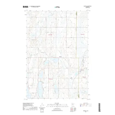
2019 Map of Swanville
USGS Topo · Published 2019About this map
Swanville and Pillsbury anchor this portion of the Minnesota landscape where the Swan River meanders through a dense network of glacial lakes and wetlands. The settlement pattern is defined by a grid of rural roads like Grosbeak Rd and Co Hwy 12, which connect numerous family-named landmarks and local institutions. Genealogists can identify several historic burial grounds, including Bearhead Cem, Spring Brook Cem, and two separate sites for Saint Peter Cem and Saint John Cem near the town center. The terrain is characterized by large bodies of water such as Big Swan Lake and Long Lake, alongside smaller features like Polander Lake and Mons Lake, illustrating the post-glacial topography of the Todd and Morrison County line.
Find a feature on this map
49 named features on this map. Tap any name to fly to it.
Don’t see what you’re looking for? This feature index may not catch every label — zoom into the map to look around manually.
Map Details
Editions of this 2019 Swanville Map
This is the sole edition of this map. No revisions or reprints were ever made.
Other maps of this area

1947 · Flensburg
USGS Topo · 1:25,000

1948 · Cushing
USGS Topo · 1:62,500

1950 · Swanville
USGS Topo · 1:62,500

1950 · Cushing
USGS Topo · 1:62,500

1951 · Flensburg
USGS Topo · 1:25,000

1953 · Brainerd
USGS Topo · 1:250,000

1953 · Saint Cloud
USGS Topo · 1:250,000

1957 · Brainerd
USGS Topo · 1:250,000

1957 · Saint Cloud
USGS Topo · 1:250,000

1958 · Saint Cloud
USGS Topo · 1:250,000