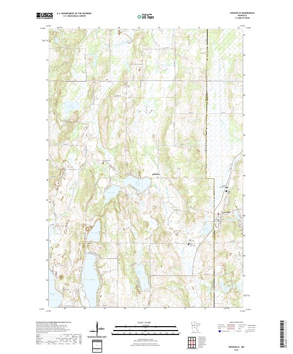
2022 Map of Swanville
USGS Topo · Published 2022About this map
Swanville sits at the junction of the Todd Co Morrison Co boundary, serving as a focal point for this landscape of glacial lakes and wetlands. The terrain is defined by a dense network of water bodies, including the larger Big Swan Lake and Long Lake in the south, and a chain of smaller basins like Mons Lake and Little Swan Lake to the north. These lakes are connected by the winding course of the Swan River and the Little Swan River, which meander through low-lying marshlands and wooded pockets.
Find a feature on this map
80 named features on this map. Tap any name to fly to it.
Don’t see what you’re looking for? This feature index may not catch every label — zoom into the map to look around manually.
Map Details
Editions of this 2022 Swanville Map
This is the sole edition of this map. No revisions or reprints were ever made.
Other maps of this area

1947 · Flensburg
USGS Topo · 1:25,000

1948 · Cushing
USGS Topo · 1:62,500

1950 · Swanville
USGS Topo · 1:62,500

1950 · Cushing
USGS Topo · 1:62,500

1951 · Flensburg
USGS Topo · 1:25,000

1953 · Brainerd
USGS Topo · 1:250,000

1953 · Saint Cloud
USGS Topo · 1:250,000

1957 · Brainerd
USGS Topo · 1:250,000

1957 · Saint Cloud
USGS Topo · 1:250,000

1958 · Saint Cloud
USGS Topo · 1:250,000