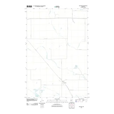
2010 Map of Swatara
USGS Topo · Published 2010About this map
The settlement of Swatara is the central hub of this Aitkin County survey, situated where the Swatara Post Office and local roads meet. The surrounding landscape is defined by an intricate network of waterways, including the winding Willow River and Little Hill River which move through the low-lying terrain. To the south and west, the map details a cluster of water bodies such as Blackwater Lake, McKinney Lake, and Little McKinney Lake, illustrating the glacial lake topography characteristic of this part of Minnesota.
Find a feature on this map
24 named features on this map. Tap any name to fly to it.
Don’t see what you’re looking for? This feature index may not catch every label — zoom into the map to look around manually.
Map Details
Editions of this 2010 Swatara Map
This is the sole edition of this map. No revisions or reprints were ever made.
Other maps of this area

1953 · Duluth
USGS Topo · 1:250,000

1954 · Hibbing
USGS Topo · 1:250,000

1957 · Hibbing
USGS Topo · 1:250,000

1958 · Hibbing
USGS Topo · 1:250,000

1958 · Duluth
USGS Topo · 1:250,000

1964 · Hibbing
USGS Topo · 1:250,000

1970 · Edna Lake
USGS Topo · 1:24,000

1970 · Big Thunder Peak
USGS Topo · 1:24,000

1970 · Shovel Lake
USGS Topo · 1:24,000
1970 · Mountain Ash Lake
USGS Topo · 1:24,000