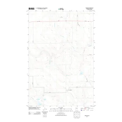
2013 Map of Swatara
USGS Topo · Published 2013About this map
The small settlement of Swatara serves as the focal point for this Aitkin County landscape, where the local post office—labeled PO Swatara—marks the community's geographic heart. The surrounding terrain is defined by a dense network of slow-moving waterways, including the winding course of the Willow River and the Little Hill River. To the south, a cluster of significant water bodies provides a distinct hydrological profile, featuring Little McKinney Lake, Blackwater Lake, and McKinney Lake. These waters, along with the Moose River, suggest a landscape historically shaped by timber and wetland navigation. Transportation in the area is anchored by MN-200 and several county routes, while more specialized naming, such as Hybrid Aspen Forest Rd, points toward the region's managed timber resources and forestry heritage.
Find a feature on this map
21 named features on this map. Tap any name to fly to it.
Don’t see what you’re looking for? This feature index may not catch every label — zoom into the map to look around manually.
Map Details
Editions of this 2013 Swatara Map
This is the sole edition of this map. No revisions or reprints were ever made.
Other maps of this area

1953 · Duluth
USGS Topo · 1:250,000

1954 · Hibbing
USGS Topo · 1:250,000

1957 · Hibbing
USGS Topo · 1:250,000

1958 · Hibbing
USGS Topo · 1:250,000

1958 · Duluth
USGS Topo · 1:250,000

1964 · Hibbing
USGS Topo · 1:250,000

1970 · Edna Lake
USGS Topo · 1:24,000

1970 · Big Thunder Peak
USGS Topo · 1:24,000

1970 · Shovel Lake
USGS Topo · 1:24,000
1970 · Mountain Ash Lake
USGS Topo · 1:24,000