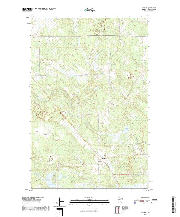
2022 Map of Swatara
USGS Topo · Published 2022About this map
Swatara serves as the central point of this Northern Minnesota landscape, situated along the diagonal path of the Soo Line North: Aitkin Trl. This corridor, which follows the historic route of the Soo Line Railroad, underscores the region's transition from an industrial rail-based economy to one defined by recreation and timber management. The terrain is densely patterned with wetlands and water bodies, including Kangas Lake and the winding course of the Willow River. To the southwest, a cluster of larger water features like Blackwater Lake, McKinney Lake, and Little McKinney Lake dominate the geography, while the Moose River and its associated Moose River Connector Trl highlight the importance of river systems in the local drainage and transport history. Access through the timberlands is provided by a network of forest roads such as Hybird Aspen Forest Rd and Kangas Lake Rd.
Find a feature on this map
34 named features on this map. Tap any name to fly to it.
Don’t see what you’re looking for? This feature index may not catch every label — zoom into the map to look around manually.
Map Details
Editions of this 2022 Swatara Map
This is the sole edition of this map. No revisions or reprints were ever made.
Other maps of this area

1953 · Duluth
USGS Topo · 1:250,000

1954 · Hibbing
USGS Topo · 1:250,000

1957 · Hibbing
USGS Topo · 1:250,000

1958 · Hibbing
USGS Topo · 1:250,000

1958 · Duluth
USGS Topo · 1:250,000

1964 · Hibbing
USGS Topo · 1:250,000

1970 · Edna Lake
USGS Topo · 1:24,000

1970 · Big Thunder Peak
USGS Topo · 1:24,000

1970 · Shovel Lake
USGS Topo · 1:24,000
1970 · Mountain Ash Lake
USGS Topo · 1:24,000