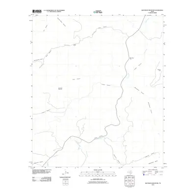
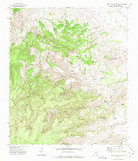
2010 Map of Swayback Mountain
USGS Topo · Published 2010About this map
Wild Rose Pass serves as a central corridor through the rugged topography of Jeff Davis County, where the road follows the winding path of Limpia Creek. This landscape is defined by its dramatic drainage networks, with numerous named canyons such as Cave Canyon, Frazier Canyon, and McCutcheon Canyon carving into the high ground. The map details the ranching heritage of the Trans-Pecos region, centered on the Powell Ranch and its namesake Powell Ranch Rd. To the south, the terrain levels into the broad Arkansas Mesa, while prominent heights like Swayback Mountain and Barbers Point provide distinct landmarks for navigation. The intricate network of ephemeral watercourses, including Chihuahua Creek and Cienega Creek, illustrates the complex hydrologic character of this arid highland environment.
Find a feature on this map
19 named features on this map. Tap any name to fly to it.
Don’t see what you’re looking for? This feature index may not catch every label — zoom into the map to look around manually.
Map Details
Editions of this 2010 Swayback Mountain Map
This is the sole edition of this map. No revisions or reprints were ever made.
Other maps of this area

1894 · Fort Davis
USGS Topo · 1:125,000

1897 · Fort Davis
USGS Topo · 1:125,000

1954 · Fort Stockton
USGS Topo · 1:250,000

1958 · Fort Stockton
USGS Topo · 1:250,000

1972 · Casket Mountain
USGS Topo · 1:24,000

1972 · Swayback Mountain
USGS Topo · 1:24,000
1972 · Big Aguja Mountain
USGS Topo · 1:24,000
1972 · Fort Davis SE
USGS Topo · 1:24,000
1972 · Fort Davis
USGS Topo · 1:24,000
1972 · Little Aguja Mountain
USGS Topo · 1:24,000