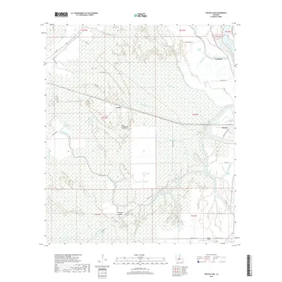
2018 Map of Swayze Lake
USGS Topo · Published 2018About this map
The West Atchafalaya Floodway dominates this landscape in St. Landry Parish, where a complex network of waterways defines the low-lying terrain. The Atchafalaya River winds along the eastern boundary, while smaller interior channels like Bayou Ha Ha, Bayou Rouge, and Negro Foot Bayou weave through the marshy bottomlands. These watercourses reflect the intricate drainage patterns of the basin, shaping the distribution of local settlements and infrastructure.
Find a feature on this map
48 named features on this map. Tap any name to fly to it.
Don’t see what you’re looking for? This feature index may not catch every label — zoom into the map to look around manually.
Map Details
Editions of this 2018 Swayze Lake Map
This is the sole edition of this map. No revisions or reprints were ever made.
Other maps of this area

1939 · Fordoche
USGS Topo · 1:62,500

1941 · Batchelor
USGS Topo · 1:62,500

1954 · Baton Rouge
USGS Topo · 1:250,000

1955 · Fordoche
USGS Topo · 1:62,500

1955 · Batchelor
USGS Topo · 1:62,500

1955 · Odenburg
USGS Topo · 1:62,500

1956 · Baton Rouge
USGS Topo · 1:250,000

1959 · Fordoche
USGS Topo · 1:62,500

1959 · Palmetto
USGS Topo · 1:62,500

1961 · Baton Rouge
USGS Topo · 1:250,000