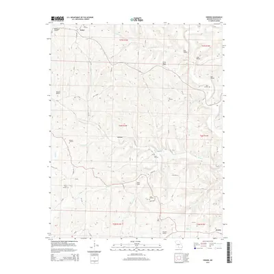
2015 Map of Sweden
USGS Topo · Published 2015About this map
Basher and the small community of Sweden anchor this 2015 study of the Ozark hills in Douglas County. The landscape is defined by its numerous drainages and deep hollows, such as Rockhouse Hollow and Watered Hollow, which flow toward the Bryant Cr and Hunter Cr systems. This map is particularly valuable for genealogists, as it preserves the locations of several family-named burial grounds including the Dyer Cemetery, Roper Cemetery, and Dobbs Cemetery.
Find a feature on this map
75 named features on this map. Tap any name to fly to it.
Don’t see what you’re looking for? This feature index may not catch every label — zoom into the map to look around manually.
Map Details
Editions of this 2015 Sweden Map
This is the sole edition of this map. No revisions or reprints were ever made.
Other maps of this area

1936 · Ava
USGS Topo · 1:48,000

1937 · Buckhart
USGS Topo · 1:48,000

1942 · Ava
USGS Topo · 1:62,500

1943 · Buckhart
USGS Topo · 1:62,500

1945 · Ava
USGS Topo · 1:62,500

1945 · Harrison
USGS Topo · 1:250,000

1945 · Buckhart
USGS Topo · 1:62,500

1949 · Harrison
USGS Topo · 1:250,000

1951 · Norwood
USGS Topo · 1:24,000
1951 · Mansfield
USGS Topo · 1:24,000