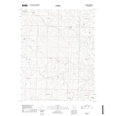
2017 Map of Sweden
USGS Topo · Published 2017About this map
Bryant Creek and its many winding tributaries, including Hunter Creek and Bill Macks Creek, carve a complex network of hollows across this part of Douglas County. The landscape is defined by its rural character, where small settlements like Sweden and Basher are connected by a web of county roads such as Co RD 14-219 and Co RD 214. Several small cemeteries, including Billingsly Cemetery, Roper Cemetery, and Whites Creek Cemetery, are located near these watercourses, suggesting a long history of family homesteads established near reliable water sources like Crystal Spring and Olive Springs. The high ground of Peaky Ridge and Iron Mountain provides a vertical contrast to the deep recesses of Sweden Hollow and Rockhouse Hollow, while the Arnika Ranch Airport represents a modern addition to this traditional Ozark terrain.
Find a feature on this map
68 named features on this map. Tap any name to fly to it.
Don’t see what you’re looking for? This feature index may not catch every label — zoom into the map to look around manually.
Map Details
Editions of this 2017 Sweden Map
This is the sole edition of this map. No revisions or reprints were ever made.
Other maps of this area

1936 · Ava
USGS Topo · 1:48,000

1937 · Buckhart
USGS Topo · 1:48,000

1942 · Ava
USGS Topo · 1:62,500

1943 · Buckhart
USGS Topo · 1:62,500

1945 · Ava
USGS Topo · 1:62,500

1945 · Harrison
USGS Topo · 1:250,000

1945 · Buckhart
USGS Topo · 1:62,500

1949 · Harrison
USGS Topo · 1:250,000

1951 · Norwood
USGS Topo · 1:24,000
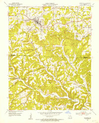
1951 · Mansfield
USGS Topo · 1:24,000