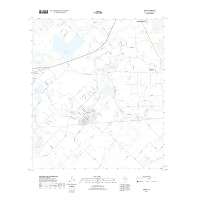
2019 Map of Sweeny
USGS Topo · Published 2019About this map
Sweeny and the surrounding Brazoria County landscape are defined by the winding course of the San Bernard River, which snakes through the eastern half of this territory. The town of Sweeny shows a clear grid of residential streets such as Elm St and Pecan St, transitioning into industrial and agricultural lands toward Old Ocean in the west. This 2019 survey captures the developed water management systems of the Texas Gulf Coast, including the large San Bernard Reservoir Number 2 and natural features like Flag Pond and Old Ocean Swamp. To the northeast, the outskirts of West Columbia appear near the banks of Bell Cr, while Wild Peach Village stands as a distinct community to the east. The map provides a look at the dense network of county roads, including Co Rd 353 and Co Rd 417, that connect these settlements across the low-lying coastal plains.
Find a feature on this map
127 named features on this map. Tap any name to fly to it.
Don’t see what you’re looking for? This feature index may not catch every label — zoom into the map to look around manually.
Map Details
Editions of this 2019 Sweeny Map
This is the sole edition of this map. No revisions or reprints were ever made.
Other maps of this area

1950 · Houston
USGS Topo · 1:250,000

1951 · Bay City
USGS Topo · 1:250,000

1952 · West Columbia
USGS Topo · 1:24,000

1952 · Sweeny
USGS Topo · 1:24,000

1952 · Danciger
USGS Topo · 1:24,000

1952 · Ashwood
USGS Topo · 1:24,000

1952 · Cedar Lane NE
USGS Topo · 1:24,000

1952 · East Columbia
USGS Topo · 1:24,000

1952 · Bay City NE
USGS Topo · 1:24,000

1952 · Brazoria
USGS Topo · 1:24,000