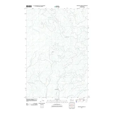
2011 Map of Sweigiler Creek
USGS Topo · Published 2011About this map
The Grays River State Fish Hatchery anchors the southern portion of this landscape in the Pacific Northwest, where the Grays River and West Fork Grays River meet. This 2011 survey reveals a complex network of timber and access roads, including Shannon Rd and several numbered routes like 1000 Rd, which navigate the steep drainage basins of the Grays River Divide. To the north, the headwaters of the Naselle River and its Little East Fork Naselle River flow through a region defined by commercial forestry and high-altitude vantage points like the Hull Creek Lookout. The map provides a detailed view of the numerous named tributaries that feed these larger systems, including Sweigiler Creek, Beaver Creek, and Shannon Creek, tracing the hydrological character of the Willapa Hills area.
Find a feature on this map
29 named features on this map. Tap any name to fly to it.
Don’t see what you’re looking for? This feature index may not catch every label — zoom into the map to look around manually.
Map Details
Editions of this 2011 Sweigiler Creek Map
This is the sole edition of this map. No revisions or reprints were ever made.
Other maps of this area

1940 · Brookfield
USGS Topo · 1:62,500

1941 · Walville
USGS Topo · 1:62,500

1941 · Skamokawa
USGS Topo · 1:62,500

1949 · Upper Naselle River
USGS Topo · 1:24,000

1949 · Rosburg
USGS Topo · 1:24,000

1953 · Hoquiam
USGS Topo · 1:250,000

1953 · Skamokawa
USGS Topo · 1:62,500

1953 · Pe Ell
USGS Topo · 1:62,500

1955 · Grays River
USGS Topo · 1:62,500

1955 · Raymond
USGS Topo · 1:62,500