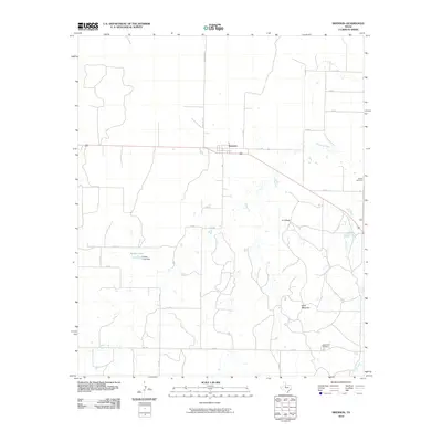
2010 Map of Swenson
USGS Topo · Published 2010About this map
Swenson serves as the central focal point of this Stonewall County landscape, situated where local roads converge in a region defined by ranching and intermittent waterways. The topography is marked by distinctive elevations such as K U Peak and Keen Mountain, providing a stark contrast to the drainages of Stinking Creek and K U Creek that weave through the territory. To the west, the man-made Parker Lake and Parker Lake Dam indicate historical efforts to manage water resources in this arid part of North Texas.
Find a feature on this map
26 named features on this map. Tap any name to fly to it.
Don’t see what you’re looking for? This feature index may not catch every label — zoom into the map to look around manually.
Map Details
Editions of this 2010 Swenson Map
This is the sole edition of this map. No revisions or reprints were ever made.
Other maps of this area

1931 · Aspermont
USGS Topo · 1:62,500

1954 · Lubbock
USGS Topo · 1:250,000

1958 · Seven Diamond L Canyon
USGS Topo · 1:24,000

1958 · Lovers Resort
USGS Topo · 1:24,000

1967 · Kiowa Peak SW
USGS Topo · 1:24,000

1968 · Double Mountains
USGS Topo · 1:24,000
1968 · Aspermont
USGS Topo · 1:24,000
1968 · Coon Hollow
USGS Topo · 1:24,000

1968 · Peacock
USGS Topo · 1:24,000
1968 · Swenson
USGS Topo · 1:24,000