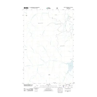
2011 Map of Swift Reservoir
USGS Topo · Published 2011About this map
Swift Reservoir and its associated Swift Dike anchor the southeastern corner of this mountainous landscape in Flathead County. The terrain is defined by high-elevation landmarks including Feather Woman Mountain, Heart Butte, and the distinctive Major Steele Backbone. A complex network of watercourses, including North Fork Birch Creek and Killem Horse Creek, drain the high ridges of the Lewis and Clark National Forest. This 2011 survey captures the area's modern infrastructure, showing the Mowitch Basin Rd as it provides access to the higher elevations. The map reveals a wild landscape where mountain summits like Mount Richmond and Mount Poia dominate a region mostly devoid of permanent settlements, focused instead on water management and forest conservation.
Find a feature on this map
26 named features on this map. Tap any name to fly to it.
Don’t see what you’re looking for? This feature index may not catch every label — zoom into the map to look around manually.
Map Details
Editions of this 2011 Swift Reservoir Map
This is the sole edition of this map. No revisions or reprints were ever made.
Other maps of this area

1913 · Marias Pass
USGS Topo · 1:125,000

1914 · Heart Butte
USGS Topo · 1:125,000

1918 · Heart Butte
USGS Topo · 1:125,000

1960 · Cut Bank
USGS Topo · 1:250,000

1963 · Cut Bank
USGS Topo · 1:250,000

1964 · Cut Bank
USGS Topo · 1:250,000

1968 · Half Dome Crag
USGS Topo · 1:24,000

1968 · Swift Reservoir
USGS Topo · 1:24,000
1968 · Gateway Pass
USGS Topo · 1:24,000

1968 · Fish Lake
USGS Topo · 1:24,000