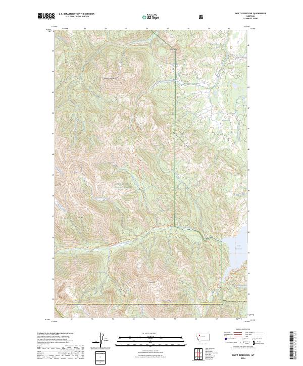
2024 Map of Swift Reservoir
USGS Topo · Published 2024About this map
The Bob Marshall Wilderness and Lewis & Clark National Forest dominate this landscape, where the high peaks of the Sawtooth Range meet the managed headwaters of the eastern slopes. The Swift Reservoir sits as a primary collection point for drainage from the North Fork Birch Creek and Phillips Creek. This area is defined by a dense network of high-altitude trails, including the North Fork Birch Creek Trl and the Two Med-Heart Butte Trl, which navigate the steep elevations between Feather Woman Mtn and Major Steele Backbone. The drainage patterns, illustrated by Hungry Man Creek and Haywood Creek, reveal the complex hydrology required to manage water resources along the Pondera and Teton County line.
Find a feature on this map
39 named features on this map. Tap any name to fly to it.
Don’t see what you’re looking for? This feature index may not catch every label — zoom into the map to look around manually.
Map Details
Editions of this 2024 Swift Reservoir Map
This is the sole edition of this map. No revisions or reprints were ever made.
Other maps of this area

1913 · Marias Pass
USGS Topo · 1:125,000

1914 · Heart Butte
USGS Topo · 1:125,000

1918 · Heart Butte
USGS Topo · 1:125,000

1960 · Cut Bank
USGS Topo · 1:250,000

1963 · Cut Bank
USGS Topo · 1:250,000

1964 · Cut Bank
USGS Topo · 1:250,000

1968 · Half Dome Crag
USGS Topo · 1:24,000

1968 · Swift Reservoir
USGS Topo · 1:24,000
1968 · Gateway Pass
USGS Topo · 1:24,000

1968 · Fish Lake
USGS Topo · 1:24,000