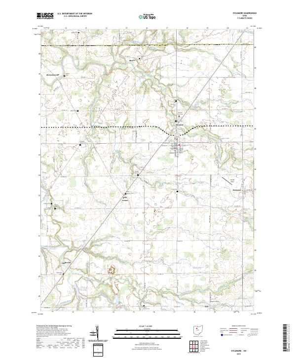
2023 Map of Sycamore
USGS Topo · Published 2023About this map
The Sandusky River winds through the western reaches of this Wyandot and Seneca County landscape, anchoring a rural region defined by its historic cemeteries and small crossroads settlements. Central to the map is the town of Sycamore, where the grid of streets like Kilbourn St and W 7th St meets the drainage of Greasy Run. The map provides a look at the distribution of family and community burial grounds that have served the area for generations, including the Old Sycamore Cem and Quaker Hill Cem.
Find a feature on this map
76 named features on this map. Tap any name to fly to it.
Don’t see what you’re looking for? This feature index may not catch every label — zoom into the map to look around manually.
Map Details
Editions of this 2023 Sycamore Map
This is the sole edition of this map. No revisions or reprints were ever made.
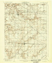
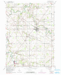
Historical Maps of Deunquat Through Time
3 maps found
Featured Locations
- Tymochtee Township, OH
- Crane Township, OH
- Eden Township, OH
- Seneca Township, OH
- Sycamore, Sycamore Township