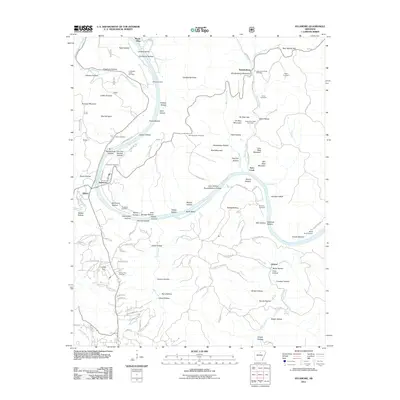
2011 Map of Sylamore
USGS Topo · Published 2011About this map
White River bends through this section of the Ozarks, carving a deep valley that defines the local landscape and commerce. The 2011 topography captures established riverfront communities like Sylamore and Mount Olive, alongside specialized local landmarks such as the Whitehouse Canning Kitchen and the White River Airport. The map is particularly detailed regarding local genealogy, noting numerous burial sites including Livingston Creek Cemetery, Jeffrey Cemetery, and the Farber Cemetery. High elevations like Wolf Mountain and Brandenburg Mountain overlook a network of hollows, including Old House Hollow and Wildcat Hollow, which speak to the area's pioneer history. Modern residential development is evident in the street layouts of Levisy Flat and Allison, connected by a web of rural routes like Hayden Heights Rd and Herpel Rd.
Find a feature on this map
121 named features on this map. Tap any name to fly to it.
Don’t see what you’re looking for? This feature index may not catch every label — zoom into the map to look around manually.
Map Details
Editions of this 2011 Sylamore Map
This is the sole edition of this map. No revisions or reprints were ever made.
Other maps of this area

1890 · Batesville
USGS Topo · 1:125,000

1890 · Mountain Home
USGS Topo · 1:125,000

1891 · Mountain Home
USGS Topo · 1:125,000

1891 · Batesville
USGS Topo · 1:125,000

1892 · Mountain View
USGS Topo · 1:125,000

1894 · Mountain View
USGS Topo · 1:125,000

1894 · Mountain Home
USGS Topo · 1:125,000

1945 · Harrison
USGS Topo · 1:250,000

1949 · Harrison
USGS Topo · 1:250,000

1951 · Melbourne
USGS Topo · 1:62,500