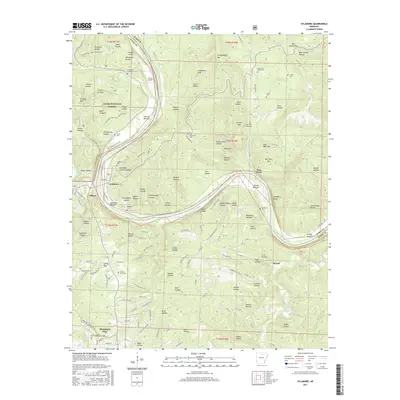
2017 Map of Sylamore
USGS Topo · Published 2017About this map
The White River winds through the heart of this landscape, separating the wooded hills of the Ozark National Forest from the small settlements of Stone County and Izard County. Along its banks, the river forms distinct features such as Landers Island and the Sylamore Bottom, where the community of Sylamore is situated. The rugged topography is defined by a dense network of hollows, including Canning Kitchen Hollow and Rattlesnake Hollow, which drop toward the river valley. For those tracing local history, several small cemeteries are scattered across the heights, such as Livingston Creek Cem and Ruddells Cem, often located near former family homesteads or old road junctions like those at Allison. Modern recreational use is visible in the Syllamo Bike Trail-White River, which follows the ridges overlooking the deep river bends.
Find a feature on this map
161 named features on this map. Tap any name to fly to it.
Don’t see what you’re looking for? This feature index may not catch every label — zoom into the map to look around manually.
Map Details
Editions of this 2017 Sylamore Map
This is the sole edition of this map. No revisions or reprints were ever made.
Other maps of this area

1890 · Batesville
USGS Topo · 1:125,000

1890 · Mountain Home
USGS Topo · 1:125,000

1891 · Mountain Home
USGS Topo · 1:125,000

1891 · Batesville
USGS Topo · 1:125,000

1892 · Mountain View
USGS Topo · 1:125,000

1894 · Mountain View
USGS Topo · 1:125,000

1894 · Mountain Home
USGS Topo · 1:125,000

1945 · Harrison
USGS Topo · 1:250,000

1949 · Harrison
USGS Topo · 1:250,000

1951 · Melbourne
USGS Topo · 1:62,500