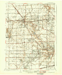
1937 Map of Sylvania
USGS Topo · Published 1937About this map
Tenmile Creek and the Ottawa River meander through this borderland landscape during a period of transition between industrial quarrying and suburban expansion. The heavy extraction sites at Medusa Quarry and France Quarry near Silica stand in contrast to the maturing residential developments of Ottawa Hills and Elden Heights. The map clearly delineates the North Boundary Twelvemile Reservation, a remnant of historical treaty lines that continues to influence local property and township divisions.
Find a feature on this map
53 named features on this map. Tap any name to fly to it.
Don’t see what you’re looking for? This feature index may not catch every label — zoom into the map to look around manually.
Map Details
Editions of this 1937 Sylvania Map
2 editions found
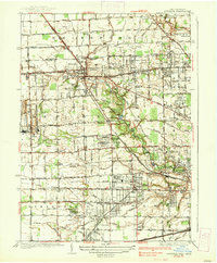
Other maps of this area

1900 · Toledo
USGS Topo · 1:62,500

1911 · Swanton
USGS Topo · 1:62,500

1912 · Dundee
USGS Topo · 1:62,500

1914 · Swanton
USGS Topo · 1:62,500

1926 · Dundee
USGS Topo · 1:62,500

1934 · Rossford
USGS Topo · 1:24,000

1935 · Whitehouse
USGS Topo · 1:24,000

1935 · Maumee
USGS Topo · 1:24,000

1935 · Berkey
USGS Topo · 1:24,000

1936 · Samaria
USGS Topo · 1:31,680