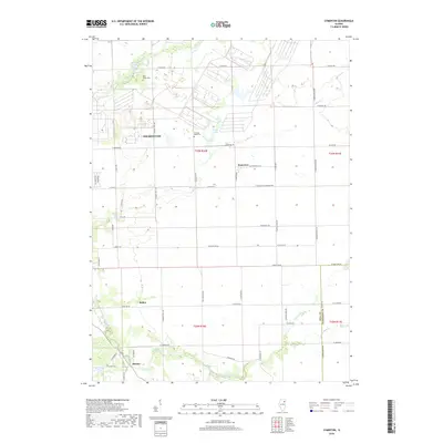
2018 Map of Symerton
USGS Topo · Published 2018About this map
Wilmington sits at the edge of a landscape defined by organized agricultural plots and winding waterways in eastern Illinois. This 2018 study documents the rural character of Will County, where the village of Symerton and the small settlement of Ballou serve as focal points for a grid of country roads. The hydrology of the area is particularly prominent, featuring the meandering paths of Forked Creek and Prairie Creek, which carve through the plains. Local history and genealogy interests are grounded in the presence of sites like Starr Grove Cem and Chicago Road Cem, which remain as long-standing landmarks amid the evolving farmland. The map also delineates the transition into Kankakee County along its southern boundary, capturing the proximity of the settlement of Ritchie near the banks of the Br Forked Cr.
Find a feature on this map
55 named features on this map. Tap any name to fly to it.
Don’t see what you’re looking for? This feature index may not catch every label — zoom into the map to look around manually.
Map Details
Editions of this 2018 Symerton Map
This is the sole edition of this map. No revisions or reprints were ever made.
Other maps of this area

1892 · Wilmington
USGS Topo · 1:62,500

1918 · Wilmington
USGS Topo · 1:62,500

1922 · Kankakee
USGS Topo · 1:62,500

1923 · Herscher
USGS Topo · 1:62,500

1924 · Kankakee
USGS Topo · 1:62,500

1925 · Herscher
USGS Topo · 1:62,500

1929 · Brisbane
USGS Topo · 1:24,000

1949 · Peotone
USGS Topo · 1:62,500
1953 · Manhattan
USGS Topo · 1:24,000

1953 · Wilton Center
USGS Topo · 1:24,000