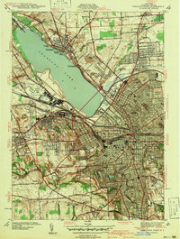
1939 Map of Syracuse West
USGS Topo · Published 1939About this map
Onondaga Lake serves as the focal point for this 1939 landscape, where industrial infrastructure and civic history converge. The city of Syracuse dominates the southeastern quadrant, showing the dense urban grid surrounding City Hall, Syracuse University, and the massive Oakwood Cemetery. The shoreline reveals a mixture of recreation and utility, from the State Fairgrounds and the Salt Museum to the New York State Barge Canal Terminal. Transport networks are highly developed, with the New York Central and Delaware Lackawanna and Western RR cutting through the terrain. Outlying industrial areas like Solvay contrast with smaller residential clusters like Liverpool and Mattydale. A notable historical detail is the site of Fort Ste Marie De Gannentaha on the lake's eastern shore, marking the region's colonial-era roots alongside modern developments like the Sewage Disposal plants and the City Market.
Find a feature on this map
66 named features on this map. Tap any name to fly to it.
Don’t see what you’re looking for? This feature index may not catch every label — zoom into the map to look around manually.
Map Details
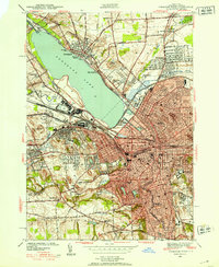
Editions of this 1939 Syracuse West Map
3 editions found
Other maps of this area

1895 · Syracuse
USGS Topo · 1:62,500

1898 · Syracuse
USGS Topo · 1:62,500

1899 · Skaneateles
USGS Topo · 1:62,500

1900 · Baldwinsville
USGS Topo · 1:62,500

1900 · Tully
USGS Topo · 1:62,500

1902 · Skaneateles
USGS Topo · 1:62,500

1938 · Syracuse East
USGS Topo · 1:24,000

1939 · Syracuse West
USGS Topo · 1:24,000

1940 · Brewerton
USGS Topo · 1:24,000

1940 · Cicero
USGS Topo · 1:24,000