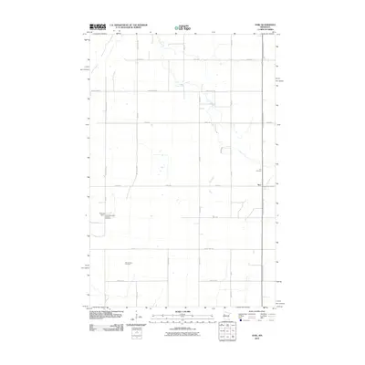
2010 Map of Syre
USGS Topo · Published 2010About this map
Syre and its surrounding agricultural plains are characterized by a grid of section roads and the meandering path of Coon Creek. This 2010 survey documents a landscape defined by its Scandinavian heritage and water management, evidenced by several burial grounds including Old Jevnaker Cemetery, Syre Cemetery, and the United Norwegian Lutheran Cemetery. The presence of Rockwell Dam and a designated Wildlife Area suggests a careful balance of land use between farming and conservation in Norman County. The Agassiz Recreational Trl runs north-south through the region, following a linear corridor that historically likely served as a transportation spine, connecting the small settlement of Syre to the broader Minnesota prairie.
Find a feature on this map
30 named features on this map. Tap any name to fly to it.
Don’t see what you’re looking for? This feature index may not catch every label — zoom into the map to look around manually.
Map Details
Editions of this 2010 Syre Map
This is the sole edition of this map. No revisions or reprints were ever made.
Other maps of this area

1918 · Twin Valley
USGS Topo · 1:62,500

1918 · Flom
USGS Topo · 1:62,500

1918 · Ulen
USGS Topo · 1:62,500

1952 · Grand Forks
USGS Topo · 1:250,000

1956 · Grand Forks
USGS Topo · 1:250,000

1965 · Waukon
USGS Topo · 1:24,000

1965 · Twin Valley SW
USGS Topo · 1:24,000

1965 · Twin Valley
USGS Topo · 1:24,000

1965 · Syre
USGS Topo · 1:24,000
1965 · Ulen NW
USGS Topo · 1:24,000