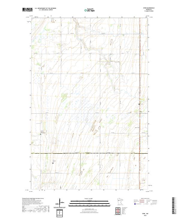
2022 Map of Syre
USGS Topo · Published 2022About this map
Syre sits at the intersection of rural thoroughfares in this portion of the Red River Valley, serving as a focal point for a landscape defined by industrial-scale agriculture and section-line roads. The area's cultural history is preserved in several local burial grounds, including the United Norwegian Lutheran Cem and the Old Jevnaker Cem, which point to the Scandinavian heritage common to this region of the Norman Co and Clay Co border. Transportation has evolved here from earlier rail corridors to modern recreational use, most notably seen in the Agassiz Recreational Trail, which follows a straight north-south path through the township. The drainage of the flat prairie is facilitated by Coon Cr, which meanders through the eastern sections near the Syre Cem.
Find a feature on this map
37 named features on this map. Tap any name to fly to it.
Don’t see what you’re looking for? This feature index may not catch every label — zoom into the map to look around manually.
Map Details
Editions of this 2022 Syre Map
This is the sole edition of this map. No revisions or reprints were ever made.
Other maps of this area

1918 · Twin Valley
USGS Topo · 1:62,500

1918 · Flom
USGS Topo · 1:62,500

1918 · Ulen
USGS Topo · 1:62,500

1952 · Grand Forks
USGS Topo · 1:250,000

1956 · Grand Forks
USGS Topo · 1:250,000

1965 · Waukon
USGS Topo · 1:24,000

1965 · Twin Valley SW
USGS Topo · 1:24,000

1965 · Twin Valley
USGS Topo · 1:24,000

1965 · Syre
USGS Topo · 1:24,000
1965 · Ulen NW
USGS Topo · 1:24,000