
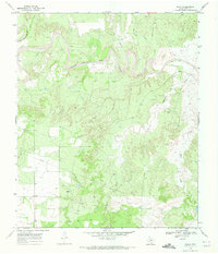
1969 Map of T-O Creek
USGS Topo · Published 1972About this map
The Salt Fork Brazos River cuts through this West Texas landscape, where the interplay of water and industry is evident in the late 1960s. The map reveals the extensive infrastructure of the T-O Field, a dense network of oil wells and access roads that characterize the region's mid-century petroleum development. Topographic details are defined by winding drainage features like Salt Creek, Snake Hollow, and Joe Smith Draw, which carve through the high plains terrain. A lone Landing Strip suggests the necessity of aerial travel in this expansive cattle and oil country. Genealogists and local historians can trace family-named landmarks such as Schoolhouse Hollow and Home Draw, which reflect the early settlement patterns and geographic naming conventions of Kent County.
Find a feature on this map
13 named features on this map. Tap any name to fly to it.
Don’t see what you’re looking for? This feature index may not catch every label — zoom into the map to look around manually.
Map Details
Editions of this 1969 T-O Creek Map
This is the sole edition of this map. No revisions or reprints were ever made.
Other maps of this area

1954 · Lubbock
USGS Topo · 1:250,000

1962 · Twomile Creek
USGS Topo · 1:24,000

1968 · Spur SW
USGS Topo · 1:24,000

1968 · White Camp
USGS Topo · 1:24,000

1969 · Cottonwood Creek
USGS Topo · 1:24,000

1969 · Justiceburg SE
USGS Topo · 1:24,000

1969 · Cooper Mountain
USGS Topo · 1:24,000

1969 · Clairemont West
USGS Topo · 1:24,000
1969 · Polar
USGS Topo · 1:24,000
1985 · Aspermont
USGS Topo · 1:100,000