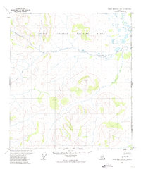
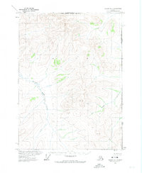
1972 Map of Table Mountain A-1
USGS Topo · Published 1974About this map
The Arctic National Wildlife Range defines this high-latitude terrain along the eastern edge of Alaska in 1972. This survey focuses on the remote watershed where the Old Crow River and Bilwaddy Creek flow through an unpopulated landscape marked only by topographic elevations like Billie, Pasture, and Tip. The United States Canada international boundary is the defining line here, marking the divide between the Alaskan wilderness and the Yukon Territory. A solitary Winter Trail provides the only recorded human path through the northern sections, indicating the seasonal nature of travel in a region where geography is shaped by hydrology and elevation rather than settlement. The map reflects a moment of environmental preservation and international demarcation before modern infrastructure or extensive commercial development reached this far north of the Arctic Circle.
Find a feature on this map
10 named features on this map. Tap any name to fly to it.
Don’t see what you’re looking for? This feature index may not catch every label — zoom into the map to look around manually.
Map Details
Editions of this 1972 Table Mountain A-1 Map
This is the sole edition of this map. No revisions or reprints were ever made.
Other maps of this area

1951 · Coleen
USGS Topo · 1:250,000

1951 · Table Mountain
USGS Topo · 1:250,000

1956 · Table Mountain
USGS Topo · 1:250,000

1956 · Coleen
USGS Topo · 1:250,000

1964 · Table Mountain
USGS Topo · 1:250,000
1972 · Table Mountain B-1
USGS Topo · 1:63,360
1972 · Coleen D-2
USGS Topo · 1:63,360
1972 · Table Mountain A-2
USGS Topo · 1:63,360
1972 · Coleen D-1
USGS Topo · 1:63,360
1972 · Table Mountain B-2
USGS Topo · 1:63,360