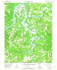
1956 Map of Table Rock Dam
USGS Topo · Published 1968About this map
Table Rock Dam dominates the central landscape of this mid-1950s survey, captured while the massive structure was still under construction. This engineering project signaled a major transformation for the White River valley, as the blue-tinted areas indicate the rising water levels that would soon submerge the surrounding terrain. To the south, the settlement of Oasis sits near Oasis Bluff, a community positioned along Long Creek before its eventual inundation by the new reservoir.
Find a feature on this map
59 named features on this map. Tap any name to fly to it.
Don’t see what you’re looking for? This feature index may not catch every label — zoom into the map to look around manually.
Map Details
Editions of this 1956 Table Rock Dam Map
5 editions found
Other maps of this area

1904 · Harrison
USGS Topo · 1:125,000

1905 · Harrison
USGS Topo · 1:125,000

1907 · Forsyth
USGS Topo · 1:125,000

1945 · Harrison
USGS Topo · 1:250,000

1949 · Harrison
USGS Topo · 1:250,000

1950 · Garber
USGS Topo · 1:24,000

1954 · Harrison
USGS Topo · 1:250,000

1956 · Lampe
USGS Topo · 1:24,000

1956 · Table Rock Dam
USGS Topo · 1:24,000

1956 · Garber
USGS Topo · 1:24,000