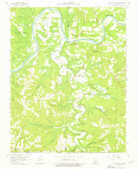
1956 Map of Table Rock Dam
USGS Topo · Published 1976About this map
Table Rock Dam (Under Construction) stands as the centerpiece of this mid-century survey, capturing the massive engineering project as it altered the White River valley. The map documents a landscape in transition, where the upcoming reservoir necessitated the relocation of communities and rural landmarks. Scattered family heritage sites like Snowden Cem and Goodall Cem are documented alongside the settlement of Oasis, situated near Oasis Bluff. To the north, Lake Taneycomo meanders past Logan Cem, while the southern reaches of the map extend to the Missouri-Arkansas state line. The topography is defined by narrow hollows and high points like Baird Mountain, providing a detailed look at the Ozark terrain before the full impact of the regional hydroelectric and recreational developments was realized.
Find a feature on this map
57 named features on this map. Tap any name to fly to it.
Don’t see what you’re looking for? This feature index may not catch every label — zoom into the map to look around manually.
Map Details
Editions of this 1956 Table Rock Dam Map
5 editions found
Other maps of this area

1904 · Harrison
USGS Topo · 1:125,000

1905 · Harrison
USGS Topo · 1:125,000

1907 · Forsyth
USGS Topo · 1:125,000

1945 · Harrison
USGS Topo · 1:250,000

1949 · Harrison
USGS Topo · 1:250,000

1950 · Garber
USGS Topo · 1:24,000

1954 · Harrison
USGS Topo · 1:250,000

1956 · Lampe
USGS Topo · 1:24,000

1956 · Table Rock Dam
USGS Topo · 1:24,000

1956 · Garber
USGS Topo · 1:24,000