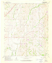
1966 Map of Tabler
USGS Topo · Published 1976About this map
Vincent and Middleberg sit along the high ground of central Grady County during the mid-1960s, a period when the local landscape was undergoing significant infrastructure modernization. The introduction of the H E Bailey Toll Road cutting across the northwest corner contrasts with the older transportation patterns of the region, specifically the Old Railroad Grade that once connected these rural communities.
Find a feature on this map
19 named features on this map. Tap any name to fly to it.
Don’t see what you’re looking for? This feature index may not catch every label — zoom into the map to look around manually.
Map Details
Editions of this 1966 Tabler Map
2 editions found
Other maps of this area

1902 · Rush Springs
USGS Topo · 1:125,000

1904 · Chickasha
USGS Topo · 1:125,000

1949 · Rush Springs
USGS Topo · 1:62,500

1950 · Rush Springs
USGS Topo · 1:62,500

1954 · Oklahoma City
USGS Topo · 1:250,000

1957 · Ardmore
USGS Topo · 1:250,000

1957 · Oklahoma City
USGS Topo · 1:250,000

1963 · Ardmore
USGS Topo · 1:250,000

1963 · Oklahoma City
USGS Topo · 1:250,000
1965 · Dibble
USGS Topo · 1:24,000