
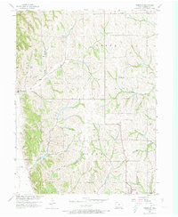
1957 Map of Tabor SW
USGS Topo · Published 1958About this map
Thurman and the outskirts of Sidney anchor this agricultural landscape in southwestern Iowa during the late 1950s. The terrain is defined by a dense network of drainage, where Dutch Hollow and Plum Creek cut through the upland loess hills towards the Missouri River basin. A prominent Levee in the southwest corner marks the boundary of the river's floodplain, protecting the low-lying fields from seasonal inundation.
Find a feature on this map
16 named features on this map. Tap any name to fly to it.
Don’t see what you’re looking for? This feature index may not catch every label — zoom into the map to look around manually.
Map Details
Editions of this 1957 Tabor SW Map
2 editions found
Other maps of this area

1907 · Nebraska City
USGS Topo · 1:62,500

1935 · Nehawka
USGS Topo · 1:48,000

1939 · Hamburg
USGS Topo · 1:62,500

1940 · Nehawka
USGS Topo · 1:62,500

1941 · Hamburg
USGS Topo · 1:62,500

1955 · Nebraska City
USGS Topo · 1:250,000

1956 · Rock Bluff
USGS Topo · 1:24,000

1957 · Nebraska City
USGS Topo · 1:250,000

1957 · Randolph
USGS Topo · 1:24,000

1957 · Tabor
USGS Topo · 1:24,000