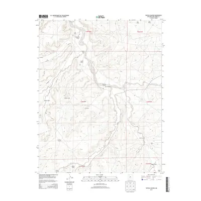
2013 Map of Tafoya Canyon
USGS Topo · Published 2013About this map
Cañon Largo serves as the central drainage for this high-desert landscape in Rio Arriba County, where the topography is defined by a dense network of branching canyons and ephemeral water sources. The map highlights the sparse ranching infrastructure of the early 21st century, including the Old Rock Ranch, Mestice Ranch, and Otero Ranch. These private holdings are situated near vital natural landmarks like Otero Spring, illustrating the continued importance of water access in this arid environment. The terrain is marked by significant geographic features such as Tafoya Canyon, Rockhouse Canyon, and the broad sweep of Rincon Largo. State and county roads, including NM-403 and CO Road 505, navigate the plateaus and canyon floors, providing the primary corridors through this complex system of valleys like Lapis Valley and La Parita Canyon.
Find a feature on this map
28 named features on this map. Tap any name to fly to it.
Don’t see what you’re looking for? This feature index may not catch every label — zoom into the map to look around manually.
Map Details
Editions of this 2013 Tafoya Canyon Map
This is the sole edition of this map. No revisions or reprints were ever made.
Other maps of this area

1889 · Largo
USGS Topo · 1:250,000

1895 · Largo
USGS Topo · 1:250,000

1954 · Aztec
USGS Topo · 1:250,000

1958 · Aztec
USGS Topo · 1:250,000

1959 · Nageezi
USGS Topo · 1:62,500

1962 · Aztec
USGS Topo · 1:250,000

1963 · Lapis Point
USGS Topo · 1:24,000

1963 · Tayfoya Canyon
USGS Topo · 1:24,000

1963 · Gonzales Mesa
USGS Topo · 1:24,000

1963 · Otero Store
USGS Topo · 1:24,000