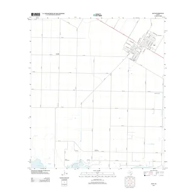
2013 Map of Taft
USGS Topo · Published 2013About this map
Taft serves as the primary urban center for this coastal Texas landscape, showcasing a grid of streets named for local significance and industrial utility. Roads such as Packinghouse Rd and Compress Rd point to the area's agricultural processing history, while the proximity to Bellevue Cem offers a point of interest for genealogical research. The surrounding terrain is largely defined by the energy sector and coastal geography. Large-scale extraction is evident across the coastal plain through the White Point Oil Field, East White Point Oil Field, and Midway Oil Field. These fields transition into the marshes and waters of Nueces Bay at the southwestern edge of the map, illustrating the intersection of industrial development and the Gulf Coast environment during the early 21st century.
Find a feature on this map
62 named features on this map. Tap any name to fly to it.
Don’t see what you’re looking for? This feature index may not catch every label — zoom into the map to look around manually.
Map Details
Editions of this 2013 Taft Map
This is the sole edition of this map. No revisions or reprints were ever made.
Other maps of this area

1925 · Robstown
USGS Topo · 1:62,500

1925 · Corpus Christi
USGS Topo · 1:62,500

1950 · Corpus Christi
USGS Topo · 1:250,000

1951 · Portland
USGS Topo · 1:24,000

1951 · Corpus Christi
USGS Topo · 1:24,000

1951 · Corpus Christi
USGS Topo · 1:62,500

1953 · Beeville
USGS Topo · 1:250,000

1954 · Woodsboro
USGS Topo · 1:62,500

1954 · Robstown
USGS Topo · 1:62,500

1954 · Sinton
USGS Topo · 1:62,500