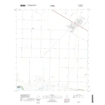
2019 Map of Taft
USGS Topo · Published 2019About this map
Taft serves as the primary hub of this coastal Texas region, where the grid-iron street plans of the town and Taft Southwest meet a vast network of rural roads. To the west, the community of Sodville anchors a landscape defined by industrial agriculture and straight-line surveying. The southern edge of the map gives way to the tidal marshes of Nueces Bay and the drainage of Gum Hollow, marking the transition into the Corpus Christi metropolitan area. Local historians will find the location of Bellevue Cem notable, as it sits at a critical junction in the southern part of town. The map's detail extends to residential street names such as Victoria Ave and Mcintyre Ave, providing a clear record of local development in San Patricio County.
Find a feature on this map
69 named features on this map. Tap any name to fly to it.
Don’t see what you’re looking for? This feature index may not catch every label — zoom into the map to look around manually.
Map Details
Editions of this 2019 Taft Map
This is the sole edition of this map. No revisions or reprints were ever made.
Other maps of this area

1925 · Robstown
USGS Topo · 1:62,500

1925 · Corpus Christi
USGS Topo · 1:62,500

1950 · Corpus Christi
USGS Topo · 1:250,000

1951 · Portland
USGS Topo · 1:24,000

1951 · Corpus Christi
USGS Topo · 1:24,000

1951 · Corpus Christi
USGS Topo · 1:62,500

1953 · Beeville
USGS Topo · 1:250,000

1954 · Woodsboro
USGS Topo · 1:62,500

1954 · Robstown
USGS Topo · 1:62,500

1954 · Sinton
USGS Topo · 1:62,500