Loading...
Loading map...2022 Map of Taft
USGS Topo · Published 2022About this map
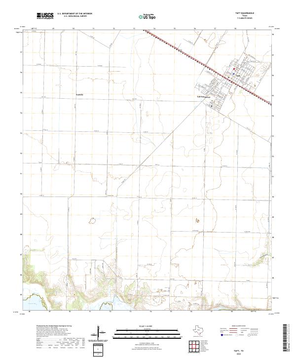
Taft and its residential extensions, including Taft Southwest, dominate the northeastern corner of this San Patricio County landscape. The grid-patterned streets of the main town site contrast sharply with the sprawling agricultural tracts that define the surrounding coastal plains. Small rural clusters like Sodville are linked by a dense network of Farm to Market roads, such as FM 1074 and FM 1944, which facilitate the region's agricultural economy.
Find a feature on this map
69 named features on this map. Tap any name to fly to it.
Don’t see what you’re looking for? This feature index may not catch every label — zoom into the map to look around manually.
Map Details
Date Portrayed2022
Date Published2022
PublisherU.S. Geological Survey
Map TypeTopographic
Scale1:24000
Physical Dimensions24 x 29 inches
Editions of this 2022 Taft Map
This is the sole edition of this map. No revisions or reprints were ever made.
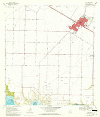
Historical Maps of Taft Southwest Through Time
Featured Locations
Source Details
SourceU.S. Geological Survey
CopyrightPublic Domain