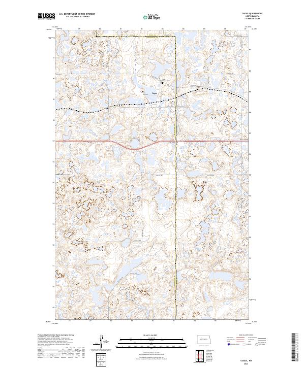
2024 Map of Tagus
USGS Topo · Published 2024About this map
The small settlement of Tagus sits at the intersection of Tagus St and Old Hwy 2, serving as a central point in this prairie landscape along the border of Mountrail and Ward Counties. This area is defined by its numerous small wetlands and glacial potholes, many of which are protected within the Mountrail County Waterfowl Production Area and the Ward County Waterfowl Production Area. These conservation tracts, including the Wcwpa, illustrate the region's commitment to habitat preservation within the North Dakota plains. Local heritage is preserved at the Saint Olaf Cem and Tagus Lutheran Cem, which stand as landmarks for genealogists tracing families in these rural townships. The land is organized by a strict grid of section lines, with routes like Co Hwy 8 and 86th Ave NW facilitating movement across the undulating terrain.
Find a feature on this map
33 named features on this map. Tap any name to fly to it.
Don’t see what you’re looking for? This feature index may not catch every label — zoom into the map to look around manually.
Map Details
Editions of this 2024 Tagus Map
This is the sole edition of this map. No revisions or reprints were ever made.
Other maps of this area

1949 · Hartland
USGS Topo · 1:24,000

1953 · Williston
USGS Topo · 1:250,000

1954 · Minot
USGS Topo · 1:250,000

1957 · Williston
USGS Topo · 1:250,000

1958 · Minot
USGS Topo · 1:250,000

1980 · Minot
USGS Topo · 1:100,000

1980 · Tagus SE
USGS Topo · 1:24,000
1980 · Aurelia
USGS Topo · 1:24,000

1980 · Tagus
USGS Topo · 1:24,000
1980 · Plaza NE
USGS Topo · 1:24,000