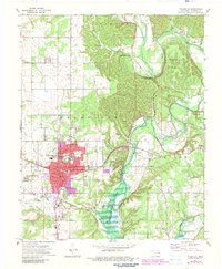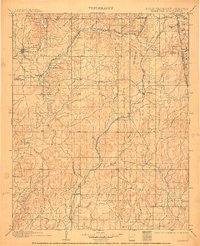
1901 Map of Tahlequah
USGS Topo · Published 1910About this map
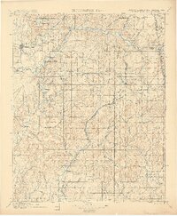
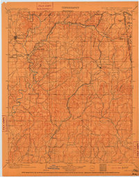
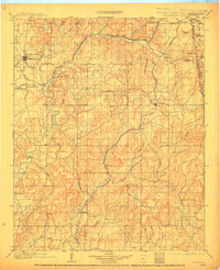
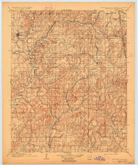
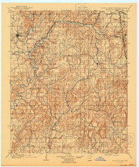
Tahlequah serves as the focal point of this turn-of-the-century survey, conducted when the region was still part of the Indian Territory before Oklahoma statehood. The map illustrates a landscape of cultural significance, noting the Female Seminary and the Cherokee Insane Asylum near Parkhill. The Illinois River and Barren Fork cut through the terrain, which rises into the southern Brushy Mountains. Institutional history is further preserved at the Elm Springs Mission near Welling. Transportation is defined by two major rail lines: the St. Louis and Francisco R. R. and the Kansas City Southern R. R., which anchored many of the early towns. These tracks connect settlements such as Stilwell, Westville, and Bunch, reflecting the burgeoning rail economy that reshaped the Cherokee Nation's lands at the close of the 19th century.
Find a feature on this map
63 named features on this map. Tap any name to fly to it.
Don’t see what you’re looking for? This feature index may not catch every label — zoom into the map to look around manually.
Map Details
Editions of this 1901 Tahlequah Map
8 editions found

Historical Maps of Tahlequah Through Time
9 maps found