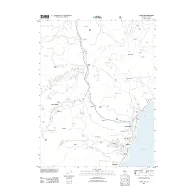
2012 Map of Tahoe City
USGS Topo · Published 2012About this map
The Truckee River flows out of Lake Tahoe at the historic Fanny Bridge, anchoring the settlement of Tahoe City during the early 21st century. This region is defined by its recreation-driven landscape, where significant alpine peaks like Mount Watson and Silver Peak overlook a series of established ski resorts and communities. The map traces the corridor between Squaw Valley and the western shores of the lake, including the residential developments of Tahoe Woods, Sunnyside, and Timberland.
Find a feature on this map
76 named features on this map. Tap any name to fly to it.
Don’t see what you’re looking for? This feature index may not catch every label — zoom into the map to look around manually.
Map Details
Editions of this 2012 Tahoe City Map
This is the sole edition of this map. No revisions or reprints were ever made.
Other maps of this area

1891 · Truckee
USGS Topo · 1:125,000

1893 · Truckee
USGS Topo · 1:125,000

1895 · Truckee
USGS Topo · 1:125,000

1932 · Truckee
USGS Topo · 1:96,000

1940 · Truckee
USGS Topo · 1:125,000

1953 · Granite Chief
USGS Topo · 1:24,000
1953 · Wentworth Springs
USGS Topo · 1:24,000

1953 · Granite Chief
USGS Topo · 1:62,500
1955 · Homewood
USGS Topo · 1:24,000

1955 · Truckee
USGS Topo · 1:24,000