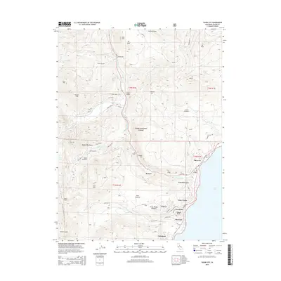
2015 Map of Tahoe City
USGS Topo · Published 2015About this map
Tahoe City and the surrounding high-altitude communities are detailed during a period of established residential and recreational growth. This survey emphasizes the geography of the Truckee River corridor, documenting the precise layout of lakeshore developments like Sunnyside, Tahoe Park, and Timberland. The map illustrates the specialized infrastructure of the region, from the iconic Fanny Bridge to the network of local roads such as Washie Way and Pineland Dr that wind through the Tahoe National Forest.
Find a feature on this map
77 named features on this map. Tap any name to fly to it.
Don’t see what you’re looking for? This feature index may not catch every label — zoom into the map to look around manually.
Map Details
Editions of this 2015 Tahoe City Map
This is the sole edition of this map. No revisions or reprints were ever made.
Other maps of this area

1891 · Truckee
USGS Topo · 1:125,000

1893 · Truckee
USGS Topo · 1:125,000

1895 · Truckee
USGS Topo · 1:125,000

1932 · Truckee
USGS Topo · 1:96,000

1940 · Truckee
USGS Topo · 1:125,000

1953 · Granite Chief
USGS Topo · 1:24,000
1953 · Wentworth Springs
USGS Topo · 1:24,000

1953 · Granite Chief
USGS Topo · 1:62,500
1955 · Homewood
USGS Topo · 1:24,000

1955 · Truckee
USGS Topo · 1:24,000