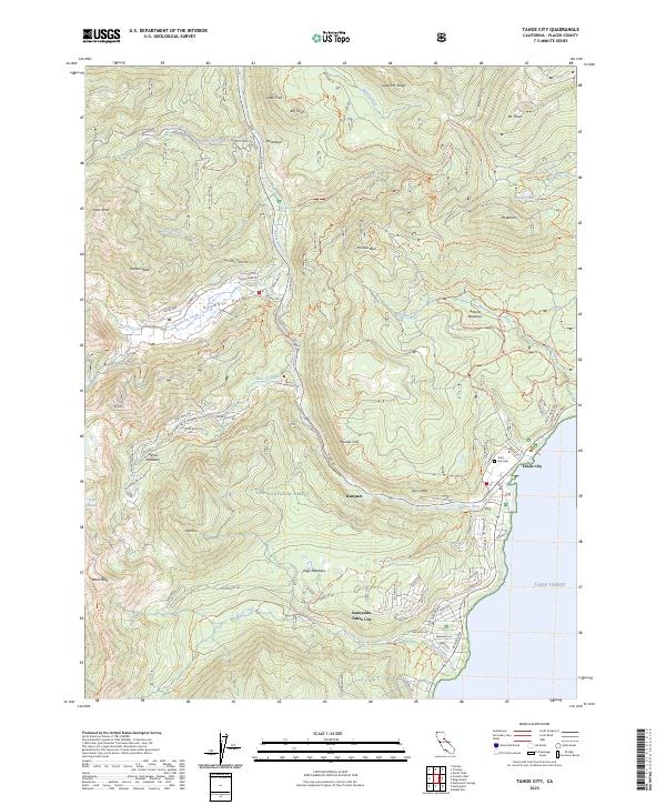
2023 Map of Tahoe City
USGS Topo · Published 2023About this map
Tahoe City and the surrounding Sierra Nevada landscape are documented here as they appeared in 2023, showcasing the dense network of recreation and residential development along the northwest shore of Lake Tahoe. The map details the transition from the lakefront communities of Sunnyside-Tahoe City to the high-elevation terrain of the Tahoe National Forest. Significant recreational infrastructure is visible, including the trails at Olympic Valley and Alpine Meadows, as well as the specialized routes like the The Great Ski Race Trl and the Tahoe Rim Trl.
Find a feature on this map
95 named features on this map. Tap any name to fly to it.
Don’t see what you’re looking for? This feature index may not catch every label — zoom into the map to look around manually.
Map Details
Editions of this 2023 Tahoe City Map
This is the sole edition of this map. No revisions or reprints were ever made.
Other maps of this area

1891 · Truckee
USGS Topo · 1:125,000

1893 · Truckee
USGS Topo · 1:125,000

1895 · Truckee
USGS Topo · 1:125,000

1932 · Truckee
USGS Topo · 1:96,000

1940 · Truckee
USGS Topo · 1:125,000

1953 · Granite Chief
USGS Topo · 1:24,000
1953 · Wentworth Springs
USGS Topo · 1:24,000

1953 · Granite Chief
USGS Topo · 1:62,500
1955 · Homewood
USGS Topo · 1:24,000

1955 · Truckee
USGS Topo · 1:24,000