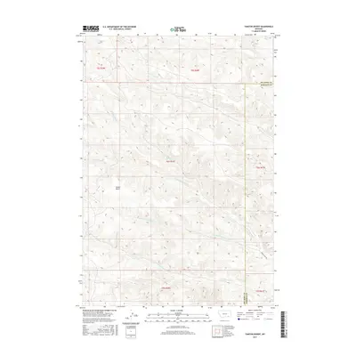
2017 Map of Taintor Desert
USGS Topo · Published 2017About this map
Taintor Desert defines the arid, high-country character of this landscape along the border of Big Horn and Rosebud counties. The terrain is deeply incised by a complex network of seasonal drainages including Taintor Fork Canyon Cr, Clarks Fork Canyon Cr, and S Fork Canyon Cr. These watercourses flow through high ridges and plateaus, illustrating the erosive forces that shaped this remote portion of southeastern Montana.
Find a feature on this map
13 named features on this map. Tap any name to fly to it.
Don’t see what you’re looking for? This feature index may not catch every label — zoom into the map to look around manually.
Map Details
Editions of this 2017 Taintor Desert Map
This is the sole edition of this map. No revisions or reprints were ever made.
Other maps of this area

1954 · Hardin
USGS Topo · 1:250,000

1957 · Hardin
USGS Topo · 1:250,000

1958 · Hardin
USGS Topo · 1:250,000

1958 · Bull Creek Lookout
USGS Topo · 1:24,000

1958 · Birdseye Spring
USGS Topo · 1:24,000

1967 · Tongue River Dam
USGS Topo · 1:24,000
1967 · Cook Creek Butte
USGS Topo · 1:24,000

1967 · Kirby
USGS Topo · 1:24,000
1967 · Spring Gulch
USGS Topo · 1:24,000
1967 · Taintor Desert
USGS Topo · 1:24,000