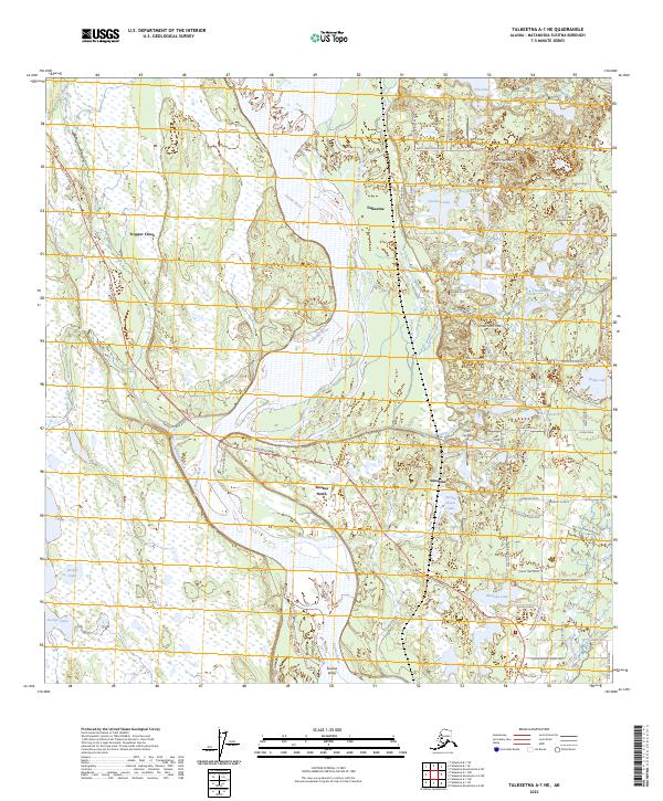
2023 Map of Talkeetna A-1 NE
USGS Topo · Published 2023About this map
The Susitna River dominates this landscape in the Matanuska-Susitna Borough, dividing the western settlements of Trapper Creek and Susitna North from the rail and road hubs to the east. This modern topography reveals a complex network of glacial lakes and river channels, including Birch Creek Slough and the uniquely named Question Lake and Little Question Lake. The transport infrastructure is well-defined, showing the Parks Highway corridor as it passes through Sunshine and Susitna Valley.
Find a feature on this map
76 named features on this map. Tap any name to fly to it.
Don’t see what you’re looking for? This feature index may not catch every label — zoom into the map to look around manually.
Map Details
Editions of this 2023 Talkeetna A-1 NE Map
This is the sole edition of this map. No revisions or reprints were ever made.
Other maps of this area

1949 · Talkeetna Mountains B-6
USGS Topo · 1:63,360

1950 · Talkeetna Mountains
USGS Topo · 1:250,000

1950 · Talkeetna
USGS Topo · 1:250,000

1950 · Talkeetna Mountains A-6
USGS Topo · 1:63,360

1951 · Talkeetna
USGS Topo · 1:250,000

1951 · Talkeetna B-1
USGS Topo · 1:63,360

1952 · Talkeetna Mountains B-6
USGS Topo · 1:63,360

1952 · Talkeetna A-1
USGS Topo · 1:63,360
1952 · Talkeetna Mountains A-6
USGS Topo · 1:63,360

1954 · Talkeetna Mountains
USGS Topo · 1:250,000