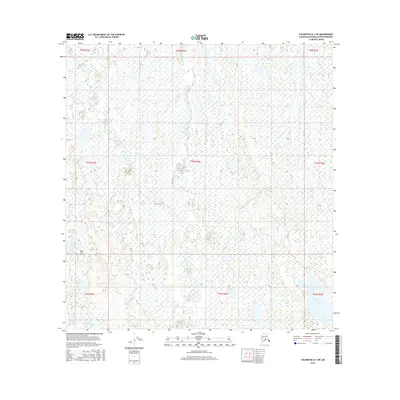
2016 Map of Talkeetna A-1 SW
USGS Topo · Published 2016About this map
Moose Creek and Kroto Creek thread through this expansive wetland landscape within the Matanuska-Susitna Borough, revealing a territory defined by its complex hydrology. The presence of the Parker Lake Airport near the shores of Parker Lake highlights the importance of bush aviation for accessing this roadless region of Southcentral Alaska. To the southeast, Trapper Lake sits amidst a dense network of smaller unnamed water bodies and marshlands. This 2016 survey illustrates the intricate drainage patterns of the Susitna River basin, where the absence of established towns emphasizes the wilderness character of the township and range grids, including t23n r6w and t22n r7w. The map serves as a primary record of the terrain as it existed in the early 21st century, showing a landscape largely untouched by industrial development.
Find a feature on this map
14 named features on this map. Tap any name to fly to it.
Don’t see what you’re looking for? This feature index may not catch every label — zoom into the map to look around manually.
Map Details
Editions of this 2016 Talkeetna A-1 SW Map
This is the sole edition of this map. No revisions or reprints were ever made.
Other maps of this area

1949 · Tyonek
USGS Topo · 1:250,000

1950 · Talkeetna
USGS Topo · 1:250,000

1951 · Talkeetna
USGS Topo · 1:250,000

1951 · Tyonek
USGS Topo · 1:250,000

1952 · Tyonek D-1
USGS Topo · 1:63,360

1952 · Talkeetna A-1
USGS Topo · 1:63,360

1954 · Tyonek D-2
USGS Topo · 1:63,360

1954 · Tyonek D-1
USGS Topo · 1:63,360

1954 · Talkeetna A-2
USGS Topo · 1:63,360
1958 · Talkeetna A-1
USGS Topo · 1:63,360