
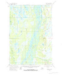
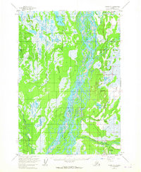
1954 Map of Tyonek D-1
USGS Topo · Published 1961About this map
The Susitna River dominates this mid-century landscape, its braided channels and Delta Islands creating a complex aquatic network through the Matanuska-Susitna region. Along the eastern bank, the Alaska Railroad serves as the primary corridor for development, connecting small outposts like Caswell, Kashwitna, and Willow Station. This era shows the early infrastructure of the Alaskan interior, with Tractor Trails and an unimproved Road paralleling the rail line, indicating the transition toward more permanent overland transport.
Find a feature on this map
28 named features on this map. Tap any name to fly to it.
Don’t see what you’re looking for? This feature index may not catch every label — zoom into the map to look around manually.
Map Details
Editions of this 1954 Tyonek D-1 Map
3 editions found
Other maps of this area

1949 · Tyonek
USGS Topo · 1:250,000

1949 · Anchorage D-8
USGS Topo · 1:63,360

1950 · Talkeetna Mountains
USGS Topo · 1:250,000

1950 · Talkeetna
USGS Topo · 1:250,000

1950 · Anchorage C-8
USGS Topo · 1:63,360

1950 · Talkeetna Mountains A-6
USGS Topo · 1:63,360

1951 · Talkeetna
USGS Topo · 1:250,000

1951 · Anchorage
USGS Topo · 1:250,000

1951 · Tyonek
USGS Topo · 1:250,000

1951 · Anchorage D-8
USGS Topo · 1:63,360