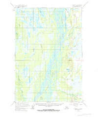
1954 Map of Tyonek D-1
USGS Topo · Published 1965About this map
The Susitna River dominates this mid-century Alaskan landscape, its braided channels creating the sprawling Delta Islands and a complex network of sloughs. Development follows the corridor of the Alaska Railroad, which serves as the primary spine for settlements like Caswell, Kashwitna, and Willow. This era shows a frontier transitioning toward organized transportation, evidenced by the Willow Station Landing Strip and various Tractor Trails cutting through the swampy lowlands.
Find a feature on this map
30 named features on this map. Tap any name to fly to it.
Don’t see what you’re looking for? This feature index may not catch every label — zoom into the map to look around manually.
Map Details
Editions of this 1954 Tyonek D-1 Map
3 editions found

Other maps of this area

1949 · Tyonek
USGS Topo · 1:250,000

1949 · Anchorage D-8
USGS Topo · 1:63,360

1950 · Talkeetna Mountains
USGS Topo · 1:250,000

1950 · Talkeetna
USGS Topo · 1:250,000

1950 · Anchorage C-8
USGS Topo · 1:63,360

1950 · Talkeetna Mountains A-6
USGS Topo · 1:63,360

1951 · Talkeetna
USGS Topo · 1:250,000

1951 · Anchorage
USGS Topo · 1:250,000

1951 · Tyonek
USGS Topo · 1:250,000

1951 · Anchorage D-8
USGS Topo · 1:63,360