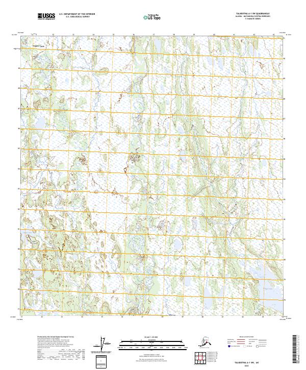
2023 Map of Talkeetna A-1 SW
USGS Topo · Published 2023About this map
Trapper Creek and its surrounding wetlands dominate this portion of the Matanuska-Susitna Borough, where an intricate network of waterways and small lakes defines the landscape. The drainage patterns of Kroto Creek and Moose Creek move through a low-lying terrain characterized by extensive marshlands and scattered forest cover. This environment is punctuated by essential aviation infrastructure like the Parker Lake Airport, which serves as a critical connection point for the dispersed residents and outdoor enthusiasts in this roadless interior. The proximity of Parker Lake and Trapper Lake suggests a landscape shaped by glacial recession, providing vital habitat and recreational opportunities in a region where the natural water cycle remains largely undisturbed by modern development.
Find a feature on this map
15 named features on this map. Tap any name to fly to it.
Don’t see what you’re looking for? This feature index may not catch every label — zoom into the map to look around manually.
Map Details
Editions of this 2023 Talkeetna A-1 SW Map
This is the sole edition of this map. No revisions or reprints were ever made.
Other maps of this area

1949 · Tyonek
USGS Topo · 1:250,000

1950 · Talkeetna
USGS Topo · 1:250,000

1951 · Talkeetna
USGS Topo · 1:250,000

1951 · Tyonek
USGS Topo · 1:250,000

1952 · Tyonek D-1
USGS Topo · 1:63,360

1952 · Talkeetna A-1
USGS Topo · 1:63,360

1954 · Tyonek D-2
USGS Topo · 1:63,360

1954 · Tyonek D-1
USGS Topo · 1:63,360

1954 · Talkeetna A-2
USGS Topo · 1:63,360
1958 · Talkeetna A-1
USGS Topo · 1:63,360