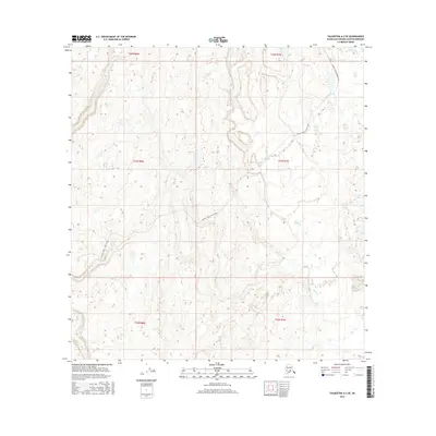
2016 Map of Talkeetna A-2 SE
USGS Topo · Published 2016About this map
The Trapper Creek Oilwell Road cuts through this landscape in the Susitna Valley, tracing a diagonal route through an area otherwise defined by water and wetlands. Flowing through the eastern portion of the quadrangle, Kroto Creek and Chijuk Cr wind through the terrain, suggesting the complex drainage patterns of this Alaskan interior. The map is organized by the Public Land Survey System, showing several townships including t23n r7w and t22n r8w, which provide a structural grid over the natural topography. This 2016 survey illustrates a largely undeveloped region where transportation is limited to primary industrial or access routes, reflecting the state's contemporary balance between resource exploration and the natural environment.
Find a feature on this map
9 named features on this map. Tap any name to fly to it.
Don’t see what you’re looking for? This feature index may not catch every label — zoom into the map to look around manually.
Map Details
Editions of this 2016 Talkeetna A-2 SE Map
This is the sole edition of this map. No revisions or reprints were ever made.
Other maps of this area

1949 · Tyonek
USGS Topo · 1:250,000

1950 · Talkeetna
USGS Topo · 1:250,000

1951 · Talkeetna
USGS Topo · 1:250,000

1951 · Tyonek
USGS Topo · 1:250,000

1952 · Talkeetna A-1
USGS Topo · 1:63,360

1954 · Tyonek D-2
USGS Topo · 1:63,360

1954 · Tyonek D-3
USGS Topo · 1:63,360

1954 · Talkeetna A-2
USGS Topo · 1:63,360
1958 · Talkeetna A-1
USGS Topo · 1:63,360

1958 · Tyonek
USGS Topo · 1:250,000