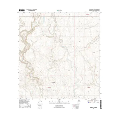
2016 Map of Talkeetna A-2 SW
USGS Topo · Published 2016About this map
Skwentna sits at a critical junction of glacial waterways in this 2016 survey of the Matanuska-Susitna region. The landscape is defined by the braided path of the Kahiltna River, which winds south to meet the Yentna River near the settlement. This area represents a complex network of tributaries including Lake Creek, Beaver Cr, and Fish Lake Cr, illustrating the dynamic hydrology of the Susitna basin. To the north, the isolated Quiet Lake and the elevation of Traleika Col provide distinct landmarks in a territory otherwise dominated by shifting river channels and wetlands. The map provides a precise record of the river systems as they appeared in the early 21st century, showing how the local terrain and settlement patterns are dictated by the flow of these massive glacial runoff routes.
Find a feature on this map
14 named features on this map. Tap any name to fly to it.
Don’t see what you’re looking for? This feature index may not catch every label — zoom into the map to look around manually.
Map Details
Editions of this 2016 Talkeetna A-2 SW Map
This is the sole edition of this map. No revisions or reprints were ever made.
Other maps of this area

1949 · Tyonek
USGS Topo · 1:250,000

1950 · Talkeetna
USGS Topo · 1:250,000

1951 · Talkeetna
USGS Topo · 1:250,000

1951 · Tyonek
USGS Topo · 1:250,000

1954 · Tyonek D-2
USGS Topo · 1:63,360

1954 · Tyonek D-3
USGS Topo · 1:63,360

1954 · Talkeetna A-3
USGS Topo · 1:63,360

1954 · Talkeetna A-2
USGS Topo · 1:63,360

1958 · Tyonek
USGS Topo · 1:250,000

1958 · Talkeetna
USGS Topo · 1:250,000